Stone Stile SW7640d
Introduction
The photograph on this page of Stone Stile SW7640d by Carrie Langford as part of the Geograph project.
The Geograph project started in 2005 with the aim of publishing, organising and preserving representative images for every square kilometre of Great Britain, Ireland and the Isle of Man.

There are currently over 7.5m images from over 14,400 individuals and you can help contribute to the project by visiting https://www.geograph.org.uk
Stone Stile SW7640d
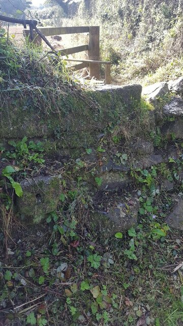
Image: © Carrie Langford Taken: 14 Oct 2021
Where the footpath across the fields joins a green lane to Lanner Farm. Approaching from the south, there is a wooden fence with a wooden stile, then the stone hedge with the stone stile. There are no protruding stones on the south side, but three protruding stones on the north side (a sheep stile) dropping into the green lane. Public footpath from the road that runs between Greensplat to Frogpool to Lanner farm. 307/32/1 (Silver). The footpath runs west and then north along the green lane. Note the green lane to the east of the stile is not a public right of way.
Images are licensed for reuse under creativecommons.org/licenses/by-sa/2.0
Image Location
Latitude
50.221735
Longitude
-5.134699