Modern Boundary Stone, The Pludds
Introduction
The photograph on this page of Modern Boundary Stone, The Pludds by Mr Red as part of the Geograph project.
The Geograph project started in 2005 with the aim of publishing, organising and preserving representative images for every square kilometre of Great Britain, Ireland and the Isle of Man.

There are currently over 7.5m images from over 14,400 individuals and you can help contribute to the project by visiting https://www.geograph.org.uk
Modern Boundary Stone, The Pludds
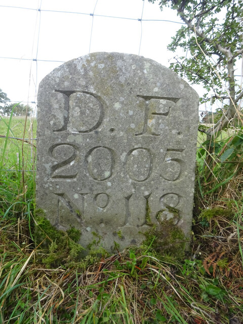
Image: © Mr Red Taken: 27 Sep 2022
On the North verge of Highbeech Road. One of the many replacement boundary stone delineating the periphery of the "Forest of Dean". The "Forest" is very specific because resident have "rights in common" like grazing sheep and coal mining, though you may have to be born there to classify as a "free miner". Inscription: D. F. / 20005 / Nᴼ. 118 Milestone Society National ID: GL_DFRUAR118em
Images are licensed for reuse under creativecommons.org/licenses/by-sa/2.0
Image Location
Latitude
51.843362
Longitude
-2.564129