Greenock - Victoria Tower
Introduction
The photograph on this page of Greenock - Victoria Tower by David Dixon as part of the Geograph project.
The Geograph project started in 2005 with the aim of publishing, organising and preserving representative images for every square kilometre of Great Britain, Ireland and the Isle of Man.

There are currently over 7.5m images from over 14,400 individuals and you can help contribute to the project by visiting https://www.geograph.org.uk
Greenock - Victoria Tower
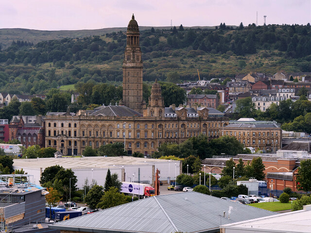
Image: © David Dixon Taken: 2 Sep 2022
The Victoria Tower (part of the municipal buildings) was completed in 1886 and stands 245 feet tall, making it a landmark visible from some distance around the area. The Municipal Building(s) is a Category A listed building (LB34122 http://portal.historicenvironment.scot/designation/LB34122 Historic Environment Scotland). The buildings and the tower now serve as a reminder of Greenock's increasing importance and wealth in the second half of the nineteenth century.
Images are licensed for reuse under creativecommons.org/licenses/by-sa/2.0
Image Location
Latitude
55.948038
Longitude
-4.75651