Bournemouth: Jacey House
Introduction
The photograph on this page of Bournemouth: Jacey House by Chris Downer as part of the Geograph project.
The Geograph project started in 2005 with the aim of publishing, organising and preserving representative images for every square kilometre of Great Britain, Ireland and the Isle of Man.

There are currently over 7.5m images from over 14,400 individuals and you can help contribute to the project by visiting https://www.geograph.org.uk
Bournemouth: Jacey House
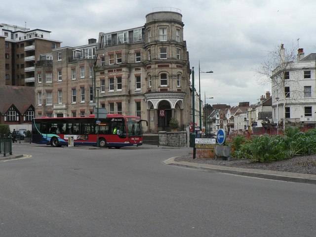
Image: © Chris Downer Taken: 18 Mar 2008
The 13 bus to Wimborne passes Jacey House at Image Now occupied by a restaurant on the ground floor, this was originally offices. In the red panel in the centre of the circular section is the date 1891. Until a few years ago the very top was adorned with the words 'JACEY HOUSE' in large letters, as can be seen in the background of Image
Images are licensed for reuse under creativecommons.org/licenses/by-sa/2.0
Image Location


Leaflet Map data © OpenStreetMap
Latitude
50.721789
Longitude
-1.867352