Minting Benedictine Priory site: aerial 2022
Introduction
The photograph on this page of Minting Benedictine Priory site: aerial 2022 by Simon Tomson as part of the Geograph project.
The Geograph project started in 2005 with the aim of publishing, organising and preserving representative images for every square kilometre of Great Britain, Ireland and the Isle of Man.

There are currently over 7.5m images from over 14,400 individuals and you can help contribute to the project by visiting https://www.geograph.org.uk
Minting Benedictine Priory site: aerial 2022
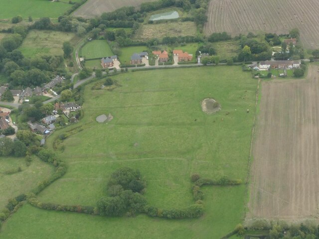
Image: © Simon Tomson Taken: 19 Sep 2022
A Benedictine priory, a cell of St Benoit-sur-Loire, founded before 1129 and granted by Ralph Earl of Chester. The earliest mention of a Prior is in 1213. The priory was dissolved in 1414. The site of the alien priory of Minting, suppressed by 1403. The site was granted in 1421 to Mount Grace Priory, North Yorkshire, as a grange. The earthworks visible represent stock compounds, yards, ponds and the grange buildings within a small moat. A broad hollow way connects the moat to the village. See: https://www.heritagegateway.org.uk/Gateway/Results_Single.aspx?uid=MLI43553&resourceID=1006
Images are licensed for reuse under creativecommons.org/licenses/by-sa/2.0
Image Location
Latitude
53.245325
Longitude
-0.2271