The Grove, Market Drayton
Introduction
The photograph on this page of The Grove, Market Drayton by Andrew Abbott as part of the Geograph project.
The Geograph project started in 2005 with the aim of publishing, organising and preserving representative images for every square kilometre of Great Britain, Ireland and the Isle of Man.

There are currently over 7.5m images from over 14,400 individuals and you can help contribute to the project by visiting https://www.geograph.org.uk
The Grove, Market Drayton
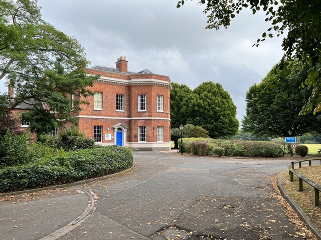
Image: © Andrew Abbott Taken: 11 Sep 2022
Grade II listed. Listing number 1056093. House, used as schoolbuilding. Circa 1770, for Colonel Thomas D'Avenant. Red brick with gauged orange brick dressings, rendered plinth and some painted stone details. Hipped plain tile roof. Double-pile plan with semi-circular bow to south-east, flanking canted bays to sides and service wing to north-east. Two storeys and attic.
Images are licensed for reuse under creativecommons.org/licenses/by-sa/2.0
Image Location
Latitude
52.906077
Longitude
-2.476335