Benchmark on Aidans, formerly St Aidan's Church
Introduction
The photograph on this page of Benchmark on Aidans, formerly St Aidan's Church by Roger Templeman as part of the Geograph project.
The Geograph project started in 2005 with the aim of publishing, organising and preserving representative images for every square kilometre of Great Britain, Ireland and the Isle of Man.

There are currently over 7.5m images from over 14,400 individuals and you can help contribute to the project by visiting https://www.geograph.org.uk
Benchmark on Aidans, formerly St Aidan's Church
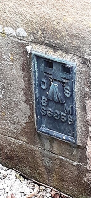
Image: © Roger Templeman Taken: 15 Sep 2022
Ordnance Survey flush bracket (serial identifier S6859) benchmark levelled in 1969 at 240.545m above Newlyn Datum and verified in 1970
Images are licensed for reuse under creativecommons.org/licenses/by-sa/2.0
Image Location


Leaflet Map data © OpenStreetMap
Latitude
54.44108
Longitude
-2.455126