Benchmark, Long Marton, Bridge 253
Introduction
The photograph on this page of Benchmark, Long Marton, Bridge 253 by Adrian Taylor as part of the Geograph project.
The Geograph project started in 2005 with the aim of publishing, organising and preserving representative images for every square kilometre of Great Britain, Ireland and the Isle of Man.

There are currently over 7.5m images from over 14,400 individuals and you can help contribute to the project by visiting https://www.geograph.org.uk
Benchmark, Long Marton, Bridge 253
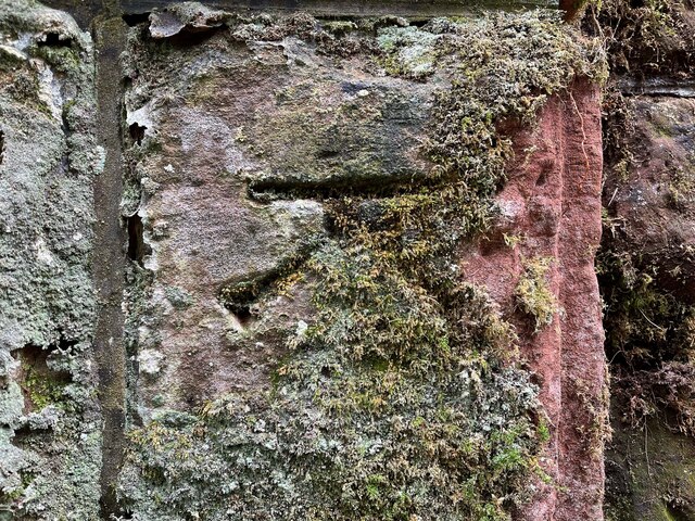
Image: © Adrian Taylor Taken: 20 Sep 2022
Detail of an Ordnance Survey cut benchmark on the end pier of the south east abutment of Park Lane Bridge on the Settle to Carlisle railway, railway engineers’ bridge reference number SAC/253. The benchmark marks a height of 132.4021m above mean sea level (Ordnance Datum Newlyn) last verified in 1955.
Images are licensed for reuse under creativecommons.org/licenses/by-sa/2.0
Image Location
Latitude
54.614801
Longitude
-2.514883