Former Toll House, Trumpet Crossroads
Introduction
The photograph on this page of Former Toll House, Trumpet Crossroads by Mr Red as part of the Geograph project.
The Geograph project started in 2005 with the aim of publishing, organising and preserving representative images for every square kilometre of Great Britain, Ireland and the Isle of Man.

There are currently over 7.5m images from over 14,400 individuals and you can help contribute to the project by visiting https://www.geograph.org.uk
Former Toll House, Trumpet Crossroads
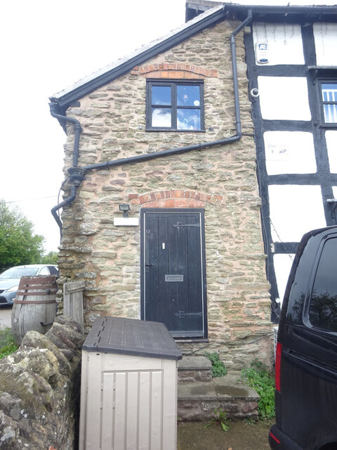
Image: © Mr Red Taken: 8 Sep 2022
The Trumpet Inn, reputedly named after the post horn as it approached the pike. The stone "catslide" extension is thought to have served as the Toll House. The Inn is Grade II listed - list no. 1302907 https://historicengland.org.uk/listing/the-list/list-entry/1302907 Milestone Society National ID: HF.PIX
Images are licensed for reuse under creativecommons.org/licenses/by-sa/2.0
Image Location
Latitude
52.053271
Longitude
-2.502792