V-shaped erosion
Introduction
The photograph on this page of V-shaped erosion by Alan Hughes as part of the Geograph project.
The Geograph project started in 2005 with the aim of publishing, organising and preserving representative images for every square kilometre of Great Britain, Ireland and the Isle of Man.

There are currently over 7.5m images from over 14,400 individuals and you can help contribute to the project by visiting https://www.geograph.org.uk
V-shaped erosion
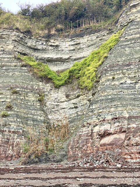
Image: © Alan Hughes Taken: 8 Sep 2022
A valley is being formed between the sedimentary rocks in the cliff faces on either side. Note the v-shape of the vegetation and the debris at the foot of the cliff.
Images are licensed for reuse under creativecommons.org/licenses/by-sa/2.0
Image Location
Latitude
51.417121
Longitude
-3.171802