School Street in Wolverhampton
Introduction
The photograph on this page of School Street in Wolverhampton by Roger Kidd as part of the Geograph project.
The Geograph project started in 2005 with the aim of publishing, organising and preserving representative images for every square kilometre of Great Britain, Ireland and the Isle of Man.

There are currently over 7.5m images from over 14,400 individuals and you can help contribute to the project by visiting https://www.geograph.org.uk
School Street in Wolverhampton
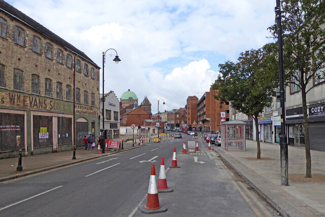
Image: © Roger Kidd Taken: 9 Sep 2022
Looking north towards Darlington Street from near the junction with Salop Street. The dome of Darlington Street Methodist Church is now visible since the Network House shops and offices on the left have been demolished. In addition, many roads in the city centre have been closed to through traffic while a slow and extensive "restructuring" and pedestrianisation is carried out. My advice to visitors driving in to Wolverhampton currently is don't, unless you know exactly where you are going, and where you will be parking. Very "challenging" for shops. Even that church closed for worship in 2019. January 2020 Image]
Images are licensed for reuse under creativecommons.org/licenses/by-sa/2.0
Image Location
Latitude
52.583964
Longitude
-2.131901