A circular walk from Reeth via Fremington Edge [5]
Introduction
The photograph on this page of A circular walk from Reeth via Fremington Edge [5] by Michael Dibb as part of the Geograph project.
The Geograph project started in 2005 with the aim of publishing, organising and preserving representative images for every square kilometre of Great Britain, Ireland and the Isle of Man.

There are currently over 7.5m images from over 14,400 individuals and you can help contribute to the project by visiting https://www.geograph.org.uk
A circular walk from Reeth via Fremington Edge [5]
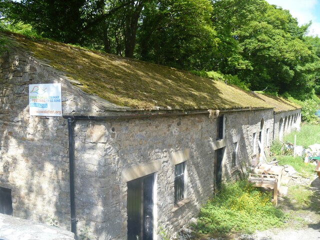
Image: © Michael Dibb Taken: 20 Jun 2022
Seen from the road is this range of stables and storage buildings. Built in the late 18th or early 19th century for the AD Mining Company. Constructed of coursed rubble stone under a stone slate roof. Listed, grade II, with details at: https://historicengland.org.uk/listing/the-list/list-entry/1131500 From Reeth the route climbs very steeply to run along rocky Fremington Edge on Marrick Moor. A gentler descent in the direction of Marrick village follows before turning right towards Grinton. Then along the banks of the River Swale and Arkle Beck to return to Reeth. About 4¾ miles.
Images are licensed for reuse under creativecommons.org/licenses/by-sa/2.0
Image Location
Latitude
54.388377
Longitude
-1.938109