Lavington's Hole in Bridgnorth
Introduction
The photograph on this page of Lavington's Hole in Bridgnorth by Mat Fascione as part of the Geograph project.
The Geograph project started in 2005 with the aim of publishing, organising and preserving representative images for every square kilometre of Great Britain, Ireland and the Isle of Man.

There are currently over 7.5m images from over 14,400 individuals and you can help contribute to the project by visiting https://www.geograph.org.uk
Lavington's Hole in Bridgnorth
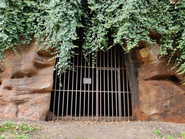
Image: © Mat Fascione Taken: 11 Sep 2022
Lavington's Hole is a Civil War tunnel dug into the sandstone cliffs under Bridgnorth Castle. The tunnel was built under the direction of a Parliamentarian engineer named Colonel Lavington in 1646. 69 feet of tunnel was dug but was not completed as the Royalists surrendered on Sunday 26th April 1646. The tunnel entrance is now covered by an iron gate, and is located in a public garden along Underhill Street.
Images are licensed for reuse under creativecommons.org/licenses/by-sa/2.0
Image Location
Latitude
52.532507
Longitude
-2.417883