Portreath, Cornwall
Introduction
The photograph on this page of Portreath, Cornwall by David Lewis as part of the Geograph project.
The Geograph project started in 2005 with the aim of publishing, organising and preserving representative images for every square kilometre of Great Britain, Ireland and the Isle of Man.

There are currently over 7.5m images from over 14,400 individuals and you can help contribute to the project by visiting https://www.geograph.org.uk
Portreath, Cornwall
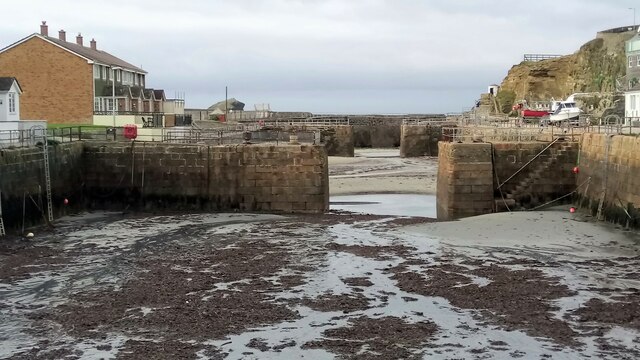
Image: © David Lewis Taken: 9 Nov 2021
Inner tidal basin, built as an extension to the harbour in 1846.
Images are licensed for reuse under creativecommons.org/licenses/by-sa/2.0
Image Location
Latitude
50.261423
Longitude
-5.289847