Nottingham Road, Eastwood
Introduction
The photograph on this page of Nottingham Road, Eastwood by Stephen McKay as part of the Geograph project.
The Geograph project started in 2005 with the aim of publishing, organising and preserving representative images for every square kilometre of Great Britain, Ireland and the Isle of Man.

There are currently over 7.5m images from over 14,400 individuals and you can help contribute to the project by visiting https://www.geograph.org.uk
Nottingham Road, Eastwood
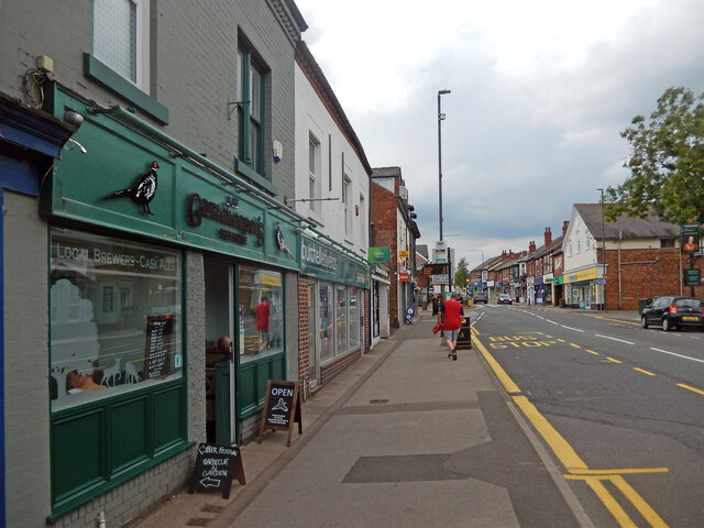
Image: © Stephen McKay Taken: 3 Sep 2022
Eastwood has been by-passed for many years but the road here was once part of the A610 between Nottingham and Heanor. The various towns and villages on the route - Nuthall, Kimberley, Giltbrook, Eastwood, Langley Mill and Heanor - long since ran into each other forming a continuous urban corridor. This is Eastwood, a workaday former mining town that has become famous on the back of its D H Lawrence connection. At one time it would have been difficult to find any reference to Lawrence here - his notoriety after the Lady Chatterley obscenity trial of 1960 made him an embarrassment in this socially conservative community - but that has all changed now. Many businesses cash in on the connection including the micropub on the left here which is called 'Gamekeeper's' (a reference to Oliver Mellors, the principal character in 'Lady Chatterley's Lover'). The pub opened in 2017 in a shop that used to sell mobility scooters. On this day it was holding a beer festival in the garden at the back. On the opposite side of the street the sign for the Wellington, a Greene King pub, can just be seen.
Images are licensed for reuse under creativecommons.org/licenses/by-sa/2.0
Image Location
Latitude
53.017172
Longitude
-1.302041