Stone Stile SW5633a
Introduction
The photograph on this page of Stone Stile SW5633a by Linda King as part of the Geograph project.
The Geograph project started in 2005 with the aim of publishing, organising and preserving representative images for every square kilometre of Great Britain, Ireland and the Isle of Man.

There are currently over 7.5m images from over 14,400 individuals and you can help contribute to the project by visiting https://www.geograph.org.uk
Stone Stile SW5633a
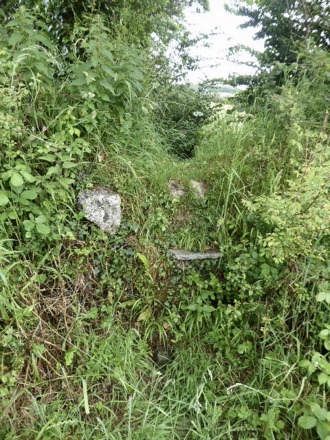
Image: © Linda King Taken: 28 Jun 2021
On a field path from Trannack Farm to Countess Bridge Lane. Sheep stile type, about 4 feet high, with small protruding steps utilising various stones of varying thicknesses. Not an easy stile to use. Both sides have two definite steps, and possibly each a third, but the lowest steps are smothered by overgrowth. Public footpath 111/20/1 silver Trannack Farm to Countess Bridge Lane.
Images are licensed for reuse under creativecommons.org/licenses/by-sa/2.0
Image Location
Latitude
50.148178
Longitude
-5.407716