Royal Military Canal - parapet path
Introduction
The photograph on this page of Royal Military Canal - parapet path by Mr Ignavy as part of the Geograph project.
The Geograph project started in 2005 with the aim of publishing, organising and preserving representative images for every square kilometre of Great Britain, Ireland and the Isle of Man.

There are currently over 7.5m images from over 14,400 individuals and you can help contribute to the project by visiting https://www.geograph.org.uk
Royal Military Canal - parapet path
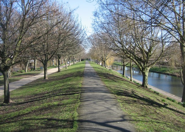
Image: © Mr Ignavy Taken: 17 Feb 2008
The canal was built to defend England when Napoleon started to mass an army of some 130,000 troops and 2,000 boats on the French coast near Boulogne. It was started on 30 October 1804 but only finished in April 1809, well after Napoleon’s plans for invasion had suffered a major setback following his navy’s defeat at the Battle of Trafalgar in 1805. The journalist William Cobbett, who toured the country on his Rural Rides during the 1820s, was typical of the critics of the canal: ‘Here is a canal made for the length of thirty miles to keep out the French; for those armies who had so often crossed the Rhine and the Danube were to be kept back by a canal thirty feet wide at most!’ The view in the photo is along the north bank parapet which was built up from the excavated soil.
Images are licensed for reuse under creativecommons.org/licenses/by-sa/2.0
Image Location
Latitude
51.070658
Longitude
1.090066