56, Royal Esplanade
Introduction
The photograph on this page of 56, Royal Esplanade by John Baker as part of the Geograph project.
The Geograph project started in 2005 with the aim of publishing, organising and preserving representative images for every square kilometre of Great Britain, Ireland and the Isle of Man.

There are currently over 7.5m images from over 14,400 individuals and you can help contribute to the project by visiting https://www.geograph.org.uk
56, Royal Esplanade
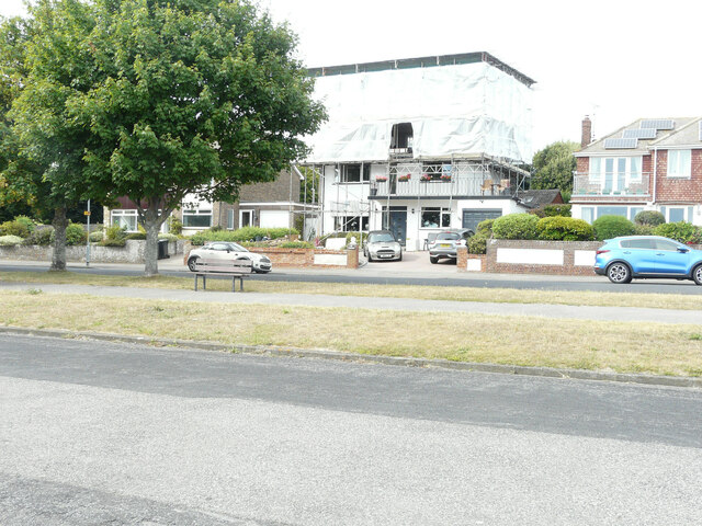
Image: © John Baker Taken: 14 Aug 2022
Planning permission has been approved by Thanet District Council under application number FH/TH/21/0902 for the “erection of dormer window to rear elevation together with balcony and roof-lights to front elevation to facilitate loft conversion”. Due to weeks of very little rain, the grass, either side of the path, had been bleached by the sun. A similar view of Image after the modifications had been completed; due to a wet summer, the grass, either side of the path, was green.
Images are licensed for reuse under creativecommons.org/licenses/by-sa/2.0
Image Location
Latitude
51.327538
Longitude
1.39862