Erme Estuary near Efford House
Introduction
The photograph on this page of Erme Estuary near Efford House by Stephen McKay as part of the Geograph project.
The Geograph project started in 2005 with the aim of publishing, organising and preserving representative images for every square kilometre of Great Britain, Ireland and the Isle of Man.

There are currently over 7.5m images from over 14,400 individuals and you can help contribute to the project by visiting https://www.geograph.org.uk
Erme Estuary near Efford House
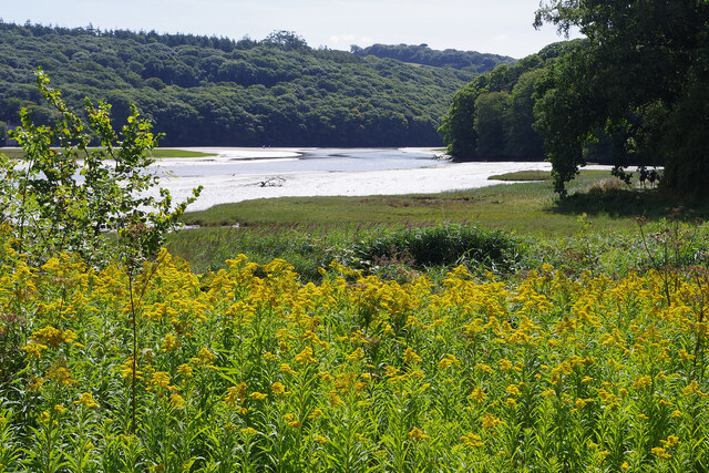
Image: © Stephen McKay Taken: 29 Aug 2022
The River Erme rises on Dartmoor but here, near Holbeton, its estuary is a ria, or drowned river valley, a geomorphological feature characteristic of the south coast of Devon and Cornwall. This view looks across a salt marsh and the mud of the estuary (it was close to low tide) to Orcheton Wood on the opposite bank.
Images are licensed for reuse under creativecommons.org/licenses/by-sa/2.0
Image Location
Latitude
50.326913
Longitude
-3.938706