Public footpath, Lode Lane, Solihull
Introduction
The photograph on this page of Public footpath, Lode Lane, Solihull by A J Paxton as part of the Geograph project.
The Geograph project started in 2005 with the aim of publishing, organising and preserving representative images for every square kilometre of Great Britain, Ireland and the Isle of Man.

There are currently over 7.5m images from over 14,400 individuals and you can help contribute to the project by visiting https://www.geograph.org.uk
Public footpath, Lode Lane, Solihull
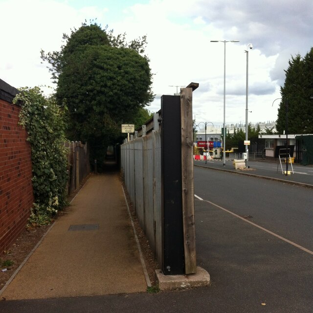
Image: © A J Paxton Taken: 29 Aug 2022
The path runs from Lode Lane to Tanhouse Farm Road and Elmdon Park. It skirts the fenced-off northern side of the Jaguar Land Rover site, one entrance to which can be seen to the right of the fence post. Fenced-off suburban gardens hem the path in on the other side, too. The OS Six Inch 1888-1913 map shows a path running from Lode Lane to the school in Elmdon Park near Elmdon Hall https://maps.nls.uk/geo/explore/side-by-side/#zoom=16&lat=52.44531&lon=-1.76364&layers=6&right=osm . The first section of the modern path follows this one, but it then turns to the left and follows long-lost field boundaries.
Images are licensed for reuse under creativecommons.org/licenses/by-sa/2.0
Image Location
Latitude
52.437573
Longitude
-1.782396