Signs of development off Crewe Lane
Introduction
The photograph on this page of Signs of development off Crewe Lane by Robin Stott as part of the Geograph project.
The Geograph project started in 2005 with the aim of publishing, organising and preserving representative images for every square kilometre of Great Britain, Ireland and the Isle of Man.

There are currently over 7.5m images from over 14,400 individuals and you can help contribute to the project by visiting https://www.geograph.org.uk
Signs of development off Crewe Lane
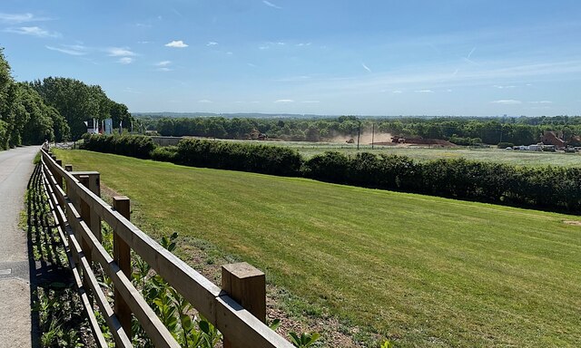
Image: © Robin Stott Taken: 27 May 2022
Housebuilders' flags and clouds of dust from earthmoving plant speak of residential development in the offing: a surprising sight. On the right edge of the photo are contractors' vehicles and behind them the derelict Crewe Gardens farm. It would appear from Warwick District Council and developers' websites that almost the entire triangle bounded by Glasshouse Lane, Crewe Lane and the A46 is to be developed for housing, an area in the order of 40 hectares.
Images are licensed for reuse under creativecommons.org/licenses/by-sa/2.0
Image Location
Latitude
52.348611
Longitude
-1.543981