A circular walk from Barnard Castle [39]
Introduction
The photograph on this page of A circular walk from Barnard Castle [39] by Michael Dibb as part of the Geograph project.
The Geograph project started in 2005 with the aim of publishing, organising and preserving representative images for every square kilometre of Great Britain, Ireland and the Isle of Man.

There are currently over 7.5m images from over 14,400 individuals and you can help contribute to the project by visiting https://www.geograph.org.uk
A circular walk from Barnard Castle [39]
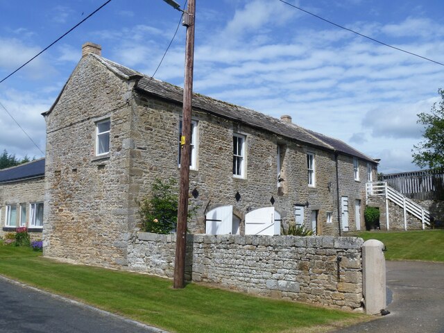
Image: © Michael Dibb Taken: 18 Jun 2022
This outbuilding in Lartington Green Lane is some 25 yards from The Grove Image It is of two builds from the early to mid 19th century. One part is of coursed rubble stone under a stone slate roof. The other part is of squared, coursed rubble stone under a Welsh slate roof. The first-floor room of the right section was used as a Methodist Chapel during the 19th and early 20th century and has a panelled wood ceiling. Listed, grade II, with details at: https://historicengland.org.uk/listing/the-list/list-entry/1121028 After crossing the River Tees, the route follows Deepdale Beck for a short distance before branching northwest to Raygill and Osmond Flatt. Then further west on a bridleway before turning north on a footpath to Lartington. After passing through the village, there is a turn to the north at Lartington Hall, then the route heads southeast past Grotto Wood and Pecknell Wood to the west bank of the river Tees, where it joins the long distance Teesdale Way to return to Barnard Castle. Just under 5½ miles.
Images are licensed for reuse under creativecommons.org/licenses/by-sa/2.0
Image Location
Latitude
54.55456
Longitude
-1.979002