Dover Priory station
Introduction
The photograph on this page of Dover Priory station by Marathon as part of the Geograph project.
The Geograph project started in 2005 with the aim of publishing, organising and preserving representative images for every square kilometre of Great Britain, Ireland and the Isle of Man.

There are currently over 7.5m images from over 14,400 individuals and you can help contribute to the project by visiting https://www.geograph.org.uk
Dover Priory station
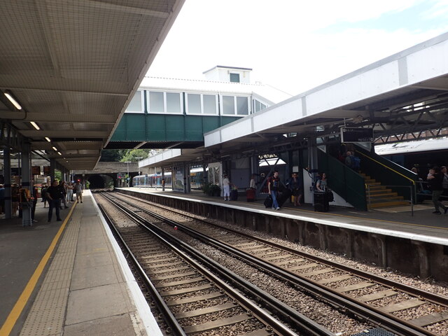
Image: © Marathon Taken: 21 Aug 2022
Dover Priory opened on 22nd July 1861 as the temporary terminus of the London, Chatham & Dover Railway from Canterbury East. It became a through station on 1st November 1861, with the completion of a tunnel through the Western Heights to gain access to the Western Docks area, where Dover Harbour station was built The station was known as Dover Town but was renamed in July 1863. This looks southwards towards the tunnel under the Western Heights. The next station in this direction is Folkestone Central. See also https://www.geograph.org.uk/photo/7265366
Images are licensed for reuse under creativecommons.org/licenses/by-sa/2.0
Image Location
Latitude
51.124582
Longitude
1.305357