Benchmark on Ruxleigh Farm
Introduction
The photograph on this page of Benchmark on Ruxleigh Farm by Neil Owen as part of the Geograph project.
The Geograph project started in 2005 with the aim of publishing, organising and preserving representative images for every square kilometre of Great Britain, Ireland and the Isle of Man.

There are currently over 7.5m images from over 14,400 individuals and you can help contribute to the project by visiting https://www.geograph.org.uk
Benchmark on Ruxleigh Farm
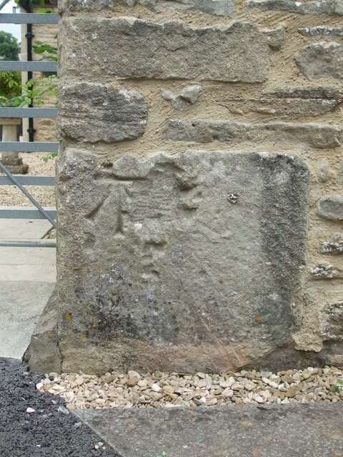
Image: © Neil Owen Taken: 23 Jul 2022
An old mark on the corner of the farmhouse was made in the nineteenth century, but appears to be missing from the official Ordnance Survey list. See https://www.bench-marks.org.uk/bm175244 for the entry in the Benchmark Database and Image] for a wider view of the forgotten mark.
Images are licensed for reuse under creativecommons.org/licenses/by-sa/2.0
Image Location
Latitude
51.460574
Longitude
-2.321076