Stone Stile SW5531a
Introduction
The photograph on this page of Stone Stile SW5531a by Linda King as part of the Geograph project.
The Geograph project started in 2005 with the aim of publishing, organising and preserving representative images for every square kilometre of Great Britain, Ireland and the Isle of Man.

There are currently over 7.5m images from over 14,400 individuals and you can help contribute to the project by visiting https://www.geograph.org.uk
Stone Stile SW5531a
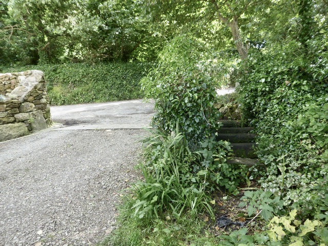
Image: © Linda King Taken: 8 Jul 2021
Just to the east of the church. A large coffen stile of five stones, at the south end of a field path to a campsite. The three central stones have gaps underneath. Each stone is 5-9" wide by 8-10" deep. The gaps are about 12" wide. Public footpath 112/86/2 gold from St Hilary churchtown to old mine workings
Images are licensed for reuse under creativecommons.org/licenses/by-sa/2.0
Image Location
Latitude
50.131203
Longitude
-5.428426