Fast Turnaround Sheltered Housing
Introduction
The photograph on this page of Fast Turnaround Sheltered Housing by MSX as part of the Geograph project.
The Geograph project started in 2005 with the aim of publishing, organising and preserving representative images for every square kilometre of Great Britain, Ireland and the Isle of Man.

There are currently over 7.5m images from over 14,400 individuals and you can help contribute to the project by visiting https://www.geograph.org.uk
Fast Turnaround Sheltered Housing
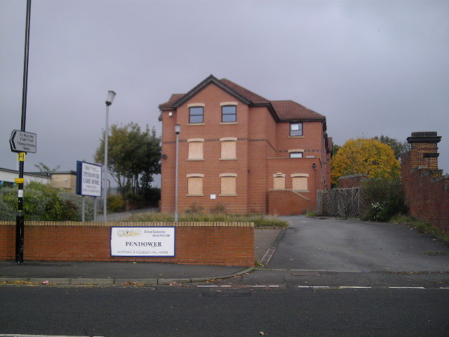
Image: © MSX Taken: 29 Oct 2005
In 1991 an old pub called "The Green Tree" stood on this site which must have been demolished to build this Old Folks' Home which in turn looks set to be demolished.
Images are licensed for reuse under creativecommons.org/licenses/by-sa/2.0
Image Location
Latitude
54.974695
Longitude
-1.681272