Flooding on the River Severn at Sheinton
Introduction
The photograph on this page of Flooding on the River Severn at Sheinton by Andrew Abbott as part of the Geograph project.
The Geograph project started in 2005 with the aim of publishing, organising and preserving representative images for every square kilometre of Great Britain, Ireland and the Isle of Man.

There are currently over 7.5m images from over 14,400 individuals and you can help contribute to the project by visiting https://www.geograph.org.uk
Flooding on the River Severn at Sheinton
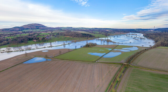
Image: © Andrew Abbott Taken: 23 Feb 2020
Flooding on the River Severn near Sheinton in February 2020, looking towards the Wrekin and Leighton. Some of the now-demolished Ironbridge Power Station is also visible in the distance.
Images are licensed for reuse under creativecommons.org/licenses/by-sa/2.0
Image Location


Leaflet Map data © OpenStreetMap
Latitude
52.641383
Longitude
-2.567