Bedale, 20 Southend
Introduction
The photograph on this page of Bedale, 20 Southend by Mel Towler as part of the Geograph project.
The Geograph project started in 2005 with the aim of publishing, organising and preserving representative images for every square kilometre of Great Britain, Ireland and the Isle of Man.

There are currently over 7.5m images from over 14,400 individuals and you can help contribute to the project by visiting https://www.geograph.org.uk
Bedale, 20 Southend
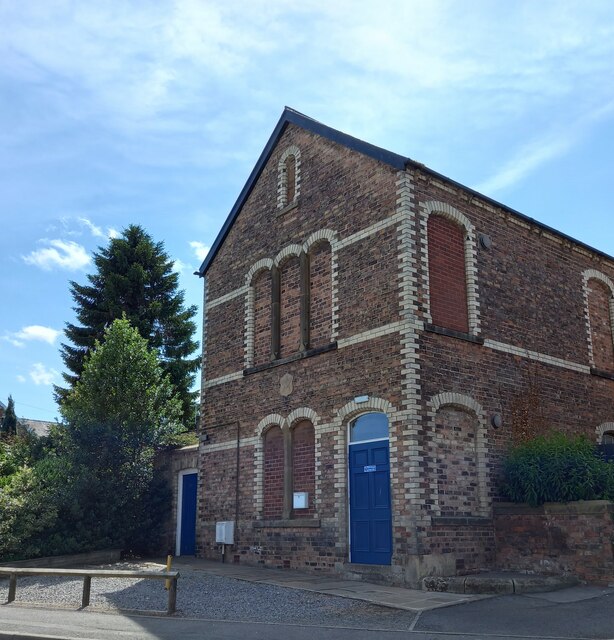
Image: © Mel Towler Taken: 16 Jul 2022
The damaged benchmark is on the north-east face of the building. The cutmark is to the right of the white meter box, and partially hidden by the vertical pipe. Only the horizontal datum line has survived.
Images are licensed for reuse under creativecommons.org/licenses/by-sa/2.0
Image Location


Leaflet Map data © OpenStreetMap
Latitude
54.287655
Longitude
-1.590894