Renishaw: former railway bridge on Spinkhill Lane
Introduction
The photograph on this page of Renishaw: former railway bridge on Spinkhill Lane by John Sutton as part of the Geograph project.
The Geograph project started in 2005 with the aim of publishing, organising and preserving representative images for every square kilometre of Great Britain, Ireland and the Isle of Man.

There are currently over 7.5m images from over 14,400 individuals and you can help contribute to the project by visiting https://www.geograph.org.uk
Renishaw: former railway bridge on Spinkhill Lane
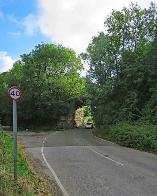
Image: © John Sutton Taken: 21 Aug 2022
A 40mph limit seems generous as the bridge is narrow by modern standards and on an almost blind dogleg. The bridge once carried the Great Central main line from Sheffield Victoria (left) to London Marylebone via Nottingham Victoria and Leicester Central. It now carries a cycle track (shown in Image]).
Images are licensed for reuse under creativecommons.org/licenses/by-sa/2.0
Image Location


Leaflet Map data © OpenStreetMap
Latitude
53.301226
Longitude
-1.333133