Broadmayne buildings [1]
Introduction
The photograph on this page of Broadmayne buildings [1] by Michael Dibb as part of the Geograph project.
The Geograph project started in 2005 with the aim of publishing, organising and preserving representative images for every square kilometre of Great Britain, Ireland and the Isle of Man.

There are currently over 7.5m images from over 14,400 individuals and you can help contribute to the project by visiting https://www.geograph.org.uk
Broadmayne buildings [1]
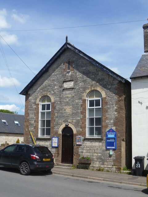
Image: © Michael Dibb Taken: 2 Jun 2022
Broadmayne Methodist church, Main Street, was built as a Wesleyan chapel in 1865. Constructed of coursed rubble stone with rick dressings and quoins under a slate roof. Broadmayne is a village in Dorset, some 3 miles southeast of Dorchester. The village is astride the A352 road from Dorchester to Wareham. There is evidence of settlement from the Stone Age onwards. In addition to agricultural activities, there was a brickworks to the north of the village. At the approach of D-Day in 1944, the area around the village was covered with Nissen huts and tents as assembly area D5 for the invasion.
Images are licensed for reuse under creativecommons.org/licenses/by-sa/2.0
Image Location
Latitude
50.678066
Longitude
-2.384062