Coombe Keynes hamlet [8]
Introduction
The photograph on this page of Coombe Keynes hamlet [8] by Michael Dibb as part of the Geograph project.
The Geograph project started in 2005 with the aim of publishing, organising and preserving representative images for every square kilometre of Great Britain, Ireland and the Isle of Man.

There are currently over 7.5m images from over 14,400 individuals and you can help contribute to the project by visiting https://www.geograph.org.uk
Coombe Keynes hamlet [8]
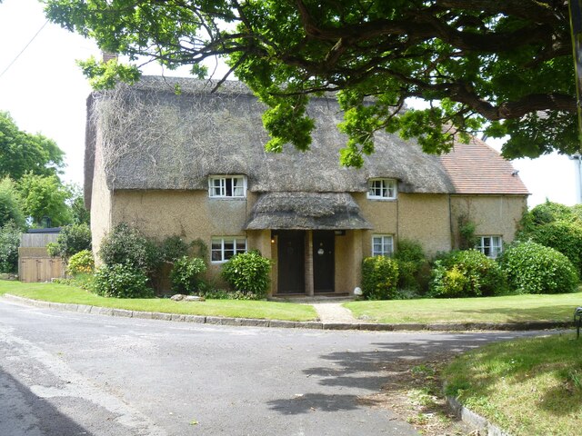
Image: © Michael Dibb Taken: 2 Jun 2022
Numbers 7 and 8 Main Street, were originally built in the 17th century and converted to two cottages in the 19th century. Constructed of rubble stone, partly roughcast, under a thatch roof. The extension on the right is of brick under a tile roof. Some windows are horizontally sliding sashes. Listed, grade II, with details at: https://historicengland.org.uk/listing/the-list/list-entry/1323337 Coombe Keynes is a hamlet, and depopulated village in Dorset, some 1½ miles south of Wool and about 5 miles southwest of Wareham. Extensive settlement remains have been found by excavation to the east of the church, indicating that once there were many more buildings. The area of earthworks, extending to some 20 acres, is a Scheduled Ancient Monument with details at: https://historicengland.org.uk/listing/the-list/list-entry/1017260
Images are licensed for reuse under creativecommons.org/licenses/by-sa/2.0
Image Location
Latitude
50.657387
Longitude
-2.224076