Former St Deiniol's Church, Criccieth
Introduction
The photograph on this page of Former St Deiniol's Church, Criccieth by Bill Harrison as part of the Geograph project.
The Geograph project started in 2005 with the aim of publishing, organising and preserving representative images for every square kilometre of Great Britain, Ireland and the Isle of Man.

There are currently over 7.5m images from over 14,400 individuals and you can help contribute to the project by visiting https://www.geograph.org.uk
Former St Deiniol's Church, Criccieth
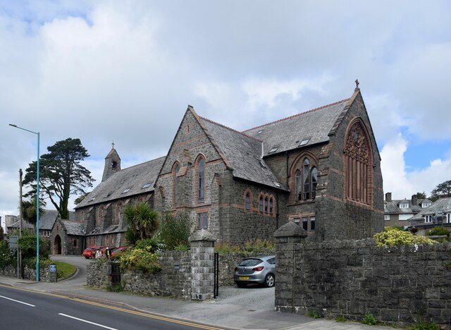
Image: © Bill Harrison Taken: 3 Jul 2022
Built ca. 1887 as a chapel of ease to accommodate English-speaking visitors to the town, now converted into flats. See Cadw record 4610 (grade II) for more: https://cadwpublic-api.azurewebsites.net/reports/listedbuilding/FullReport?lang=&id=4610 . Deiniol was supposedly the first bishop of Bangor in the 6th Century: https://en.wikipedia.org/wiki/Deiniol.
Images are licensed for reuse under creativecommons.org/licenses/by-sa/2.0
Image Location


Leaflet Map data © OpenStreetMap
Latitude
52.920236
Longitude
-4.231209