St Andrew's, Ferrybridge - north side
Introduction
The photograph on this page of St Andrew's, Ferrybridge - north side by Stephen Craven as part of the Geograph project.
The Geograph project started in 2005 with the aim of publishing, organising and preserving representative images for every square kilometre of Great Britain, Ireland and the Isle of Man.

There are currently over 7.5m images from over 14,400 individuals and you can help contribute to the project by visiting https://www.geograph.org.uk
St Andrew's, Ferrybridge - north side
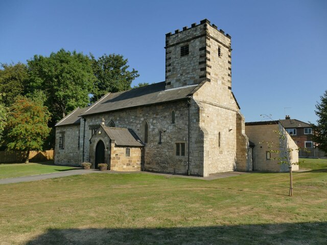
Image: © Stephen Craven Taken: 13 Aug 2022
The church of St Andrew, Ferry Fryston was of Norman origin but rebuilt in 1350 and restored and extended in 1879. Subject to frequent flooding (being near the river Aire) and then the building of a power station nearby, it was deconstructed in 1952 and rebuilt (as St Andrew, Ferrybridge) on its present site in 1954 with two new bells in the tower. Listed grade II (list entry 1265111). There are no burials in the churchyard, as the original churchyard continued in use until 1986 Image and there is now a civic cemetery nearby.
Images are licensed for reuse under creativecommons.org/licenses/by-sa/2.0
Image Location
Latitude
53.711569
Longitude
-1.273786