Low Butterby moat
Introduction
The photograph on this page of Low Butterby moat by Les Hull as part of the Geograph project.
The Geograph project started in 2005 with the aim of publishing, organising and preserving representative images for every square kilometre of Great Britain, Ireland and the Isle of Man.

There are currently over 7.5m images from over 14,400 individuals and you can help contribute to the project by visiting https://www.geograph.org.uk
Low Butterby moat
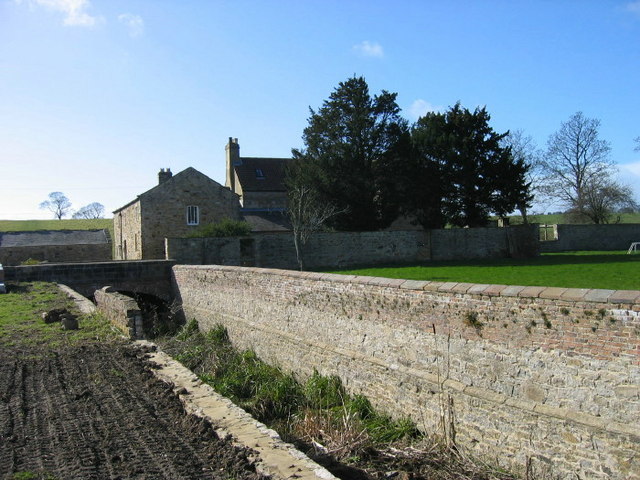
Image: © Les Hull Taken: 12 Mar 2008
The Gatehouse Web Site: Strong House. Moated and walled. The Elizabethan gatehouse, mentioned as the main survival by King, was demolished in 1966, despite being a Scheduled Ancient Monument. The moat is dry and measures c.8m wide and averages c.3m deep. The inner wall is of stone and brick, 3m high with a plinth course running along the major part of its length. Butterby, formerly Beautrove, is first noticed when Roger d'Audre was granted a licence to have a chapel or chantry within his oratory, which he had built within his manor of Beautrove. In c.1240, the manor passed to the Lumleys, and it was probably the occasional residence of this family until 1566 when it passed to the Chaytors.
Images are licensed for reuse under creativecommons.org/licenses/by-sa/2.0
Image Location
Latitude
54.748261
Longitude
-1.571819