Tithe Farm and All Saints Church, North Dalton
Introduction
The photograph on this page of Tithe Farm and All Saints Church, North Dalton by Peter Church as part of the Geograph project.
The Geograph project started in 2005 with the aim of publishing, organising and preserving representative images for every square kilometre of Great Britain, Ireland and the Isle of Man.

There are currently over 7.5m images from over 14,400 individuals and you can help contribute to the project by visiting https://www.geograph.org.uk
Tithe Farm and All Saints Church, North Dalton
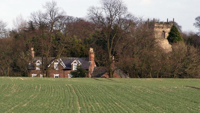
Image: © Peter Church Taken: 14 Mar 2008
Looking east across the crops to the village. The village is situated in a natural dell as illustrated by the view of the farm where the lowest 5 feet are hidden by the land until a closer view is available. The church. including the tower with battlements, dates back to Norman times. The glorious tangle of trees presumably gives a hint of how the landscape would develop without human intervention. See http://www.driffield.co.uk/wolds_village_north-dalton.htm for village information.
Images are licensed for reuse under creativecommons.org/licenses/by-sa/2.0
Image Location


Leaflet Map data © OpenStreetMap
Latitude
53.957458
Longitude
-0.577298