Old milestone on Hill Top, Knottingley
Introduction
The photograph on this page of Old milestone on Hill Top, Knottingley by Stephen Craven as part of the Geograph project.
The Geograph project started in 2005 with the aim of publishing, organising and preserving representative images for every square kilometre of Great Britain, Ireland and the Isle of Man.

There are currently over 7.5m images from over 14,400 individuals and you can help contribute to the project by visiting https://www.geograph.org.uk
Old milestone on Hill Top, Knottingley
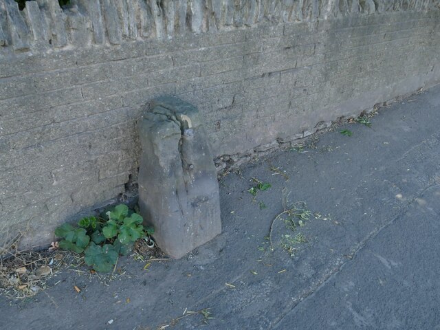
Image: © Stephen Craven Taken: 13 Aug 2022
Now lacking its original marker plate, and cracked, but an old map shows that it originally marked 3 miles to Pontefract and 12 to Wakefield. The Milestone Society's photo explains that it is 'one of only two survivors from the 1758 Wakefield to Weeland tollroad'. Milestone ID: YW_WKWL12
Images are licensed for reuse under creativecommons.org/licenses/by-sa/2.0
Image Location
Latitude
53.709513
Longitude
-1.246551