A drained section of the canal, Slaithwaite
Introduction
The photograph on this page of A drained section of the canal, Slaithwaite by Humphrey Bolton as part of the Geograph project.
The Geograph project started in 2005 with the aim of publishing, organising and preserving representative images for every square kilometre of Great Britain, Ireland and the Isle of Man.

There are currently over 7.5m images from over 14,400 individuals and you can help contribute to the project by visiting https://www.geograph.org.uk
A drained section of the canal, Slaithwaite
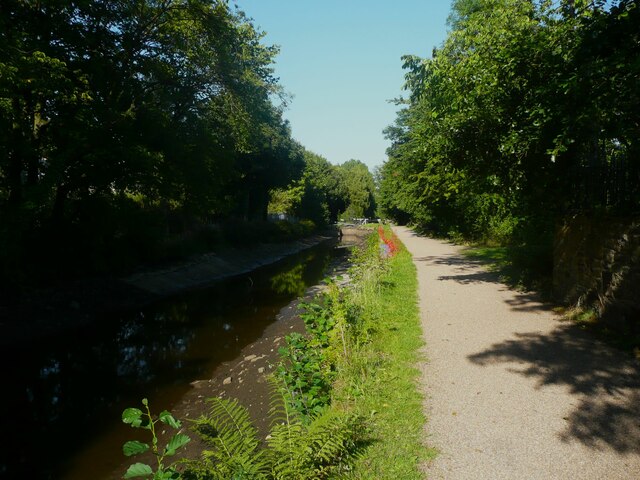
Image: © Humphrey Bolton Taken: 12 Aug 2022
Quite a long section of the canal is almost empty. This happened previously in 2018, and was then due to a build up of silt that prevented the closure of a lock gate. This scene looks rural but there is industry behind the trees on the left.
Images are licensed for reuse under creativecommons.org/licenses/by-sa/2.0
Image Location
Latitude
53.624447
Longitude
-1.871296