Stone Stile SW4739c
Introduction
The photograph on this page of Stone Stile SW4739c by Linda Camidge as part of the Geograph project.
The Geograph project started in 2005 with the aim of publishing, organising and preserving representative images for every square kilometre of Great Britain, Ireland and the Isle of Man.

There are currently over 7.5m images from over 14,400 individuals and you can help contribute to the project by visiting https://www.geograph.org.uk
Stone Stile SW4739c
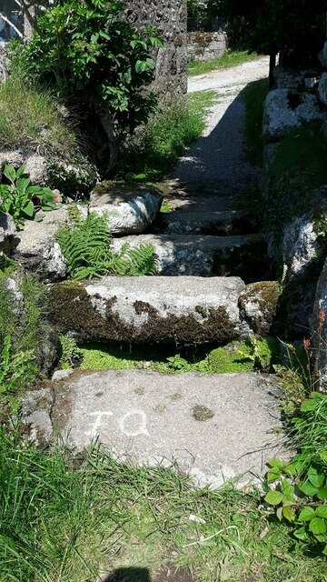
Image: © Linda Camidge Taken: 30 Jun 2021
South exit from Wicca farm buildings. Cattle stile with two large stones on either side of a central raised stone. Public footpath 120/1/2 gold from Zennor to Trowan and thence St Ives. The lettering visible in the photograph appears to mark the threshold of the farm dwellings. The Quick family lived and worked at Wicca farm between 1775 and 1908. Listed Grade II no 1137679
Images are licensed for reuse under creativecommons.org/licenses/by-sa/2.0
Image Location
Latitude
50.20096
Longitude
-5.544939