Walberswick, Main Street
Introduction
The photograph on this page of Walberswick, Main Street by Mel Towler as part of the Geograph project.
The Geograph project started in 2005 with the aim of publishing, organising and preserving representative images for every square kilometre of Great Britain, Ireland and the Isle of Man.

There are currently over 7.5m images from over 14,400 individuals and you can help contribute to the project by visiting https://www.geograph.org.uk
Walberswick, Main Street
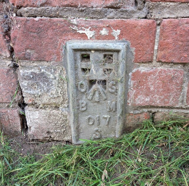
Image: © Mel Towler Taken: 4 Jul 2022
The OS Flush Bracket 017S is embedded into the road side wall on the south of The Street which runs through the village. It is on the east of the junction with Millfield Road.
Images are licensed for reuse under creativecommons.org/licenses/by-sa/2.0
Image Location
Latitude
52.313415
Longitude
1.661262