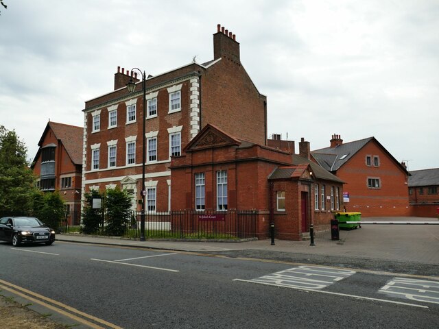
Former St John's Rectory, Vicar's Lane, Chester
Introduction
The photograph on this page of Former St John's Rectory, Vicar's Lane, Chester by Stephen Craven as part of the Geograph project.
The Geograph project started in 2005 with the aim of publishing, organising and preserving representative images for every square kilometre of Great Britain, Ireland and the Isle of Man.
There are currently over 7.5m images from over 14,400 individuals and you can help contribute to the project by visiting https://www.geograph.org.uk

Image: © Stephen Craven Taken: 23 Jun 2022
I admit to some confusion here. This building of c.1750 in a classical style, it is listed by Historic England as the former St John's Rectory (grade II* / list entry 1375975); the small church hall of 1881 to the right is also listed (II / 1385978). But the smaller 1892 building on the corner of Love Lane (which I didn't photograph) is also listed as a former rectory (II / 1375970). Clergy houses are getting smaller these days, but I can't see why a larger house would have been replaced with a smaller one in the peak of Victorian churchgoing and at a time of large families.

