Quarrymen's track
Introduction
The photograph on this page of Quarrymen's track by Jonathan Wilkins as part of the Geograph project.
The Geograph project started in 2005 with the aim of publishing, organising and preserving representative images for every square kilometre of Great Britain, Ireland and the Isle of Man.

There are currently over 7.5m images from over 14,400 individuals and you can help contribute to the project by visiting https://www.geograph.org.uk
Quarrymen's track
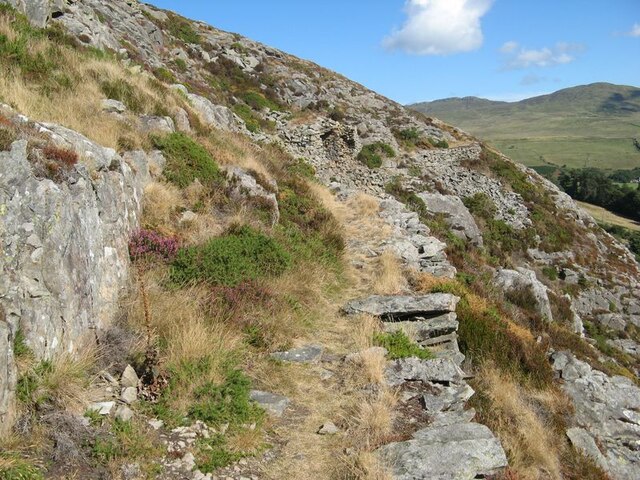
Image: © Jonathan Wilkins Taken: 4 Aug 2022
A well constructed path on an engineered embankment runs on the contour above significant cliffs before zig-zagging down to Llanfairfechan and Pendalar. It is difficult today to equate the scene with a working environment.
Images are licensed for reuse under creativecommons.org/licenses/by-sa/2.0
Image Location


Leaflet Map data © OpenStreetMap
Latitude
53.25749
Longitude
-3.959974