Barnes Meadow Estate
Introduction
The photograph on this page of Barnes Meadow Estate by Kevin Waterhouse as part of the Geograph project.
The Geograph project started in 2005 with the aim of publishing, organising and preserving representative images for every square kilometre of Great Britain, Ireland and the Isle of Man.

There are currently over 7.5m images from over 14,400 individuals and you can help contribute to the project by visiting https://www.geograph.org.uk
Barnes Meadow Estate
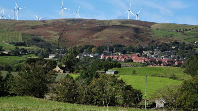
Image: © Kevin Waterhouse Taken: 27 Sep 2020
The red brick houses of the estate are prominent in this view from a path to New Barn on the A58 Halifax Road. Crook Moor wind farm is on the skyline
Images are licensed for reuse under creativecommons.org/licenses/by-sa/2.0
Image Location
Latitude
53.660077
Longitude
-2.086367