Gordon Mid Mill
Introduction
The photograph on this page of Gordon Mid Mill by Jim Barton as part of the Geograph project.
The Geograph project started in 2005 with the aim of publishing, organising and preserving representative images for every square kilometre of Great Britain, Ireland and the Isle of Man.

There are currently over 7.5m images from over 14,400 individuals and you can help contribute to the project by visiting https://www.geograph.org.uk
Gordon Mid Mill
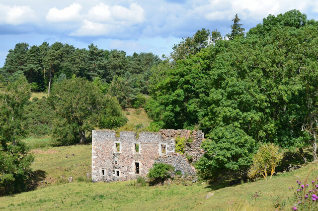
Image: © Jim Barton Taken: 5 Aug 2022
The remains of a mill near Gordon East Mains. It was powered by a mill lade from the Eden Water at a caul (weir) on the north side of the road from Gordon to Greenlaw, shown on the 6" OS map published in 1900.
Images are licensed for reuse under creativecommons.org/licenses/by-sa/2.0
Image Location


Leaflet Map data © OpenStreetMap
Latitude
55.681177
Longitude
-2.541943