Holway Level Mine, Holywell
Introduction
The photograph on this page of Holway Level Mine, Holywell by Chris Allen as part of the Geograph project.
The Geograph project started in 2005 with the aim of publishing, organising and preserving representative images for every square kilometre of Great Britain, Ireland and the Isle of Man.

There are currently over 7.5m images from over 14,400 individuals and you can help contribute to the project by visiting https://www.geograph.org.uk
Holway Level Mine, Holywell
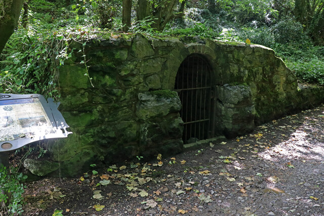
Image: © Chris Allen Taken: 31 Jul 2022
This is the entrance to the Holway Level, a two mile tunnel that lead to one of the most productive lead mines in Britain. The Level drained the water from the mine and also allowed the ore to be brought out by boat. The tunnel was developed into a tourist attraction in 1788. The galena in the mine contained up to 80% lead and 12% silver. Since 1917 this level has supplied St Winefride's well as the original supply was interrupted by the construction of the Milwr Tunnel.
Images are licensed for reuse under creativecommons.org/licenses/by-sa/2.0
Image Location
Latitude
53.278008
Longitude
-3.224933