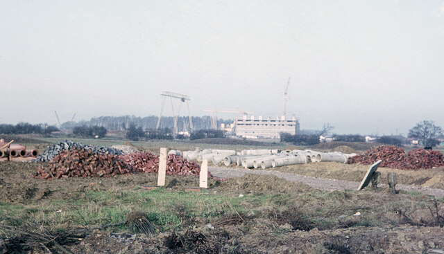
Housing development - Wollaton and Balloon Wood
Introduction
The photograph on this page of Housing development - Wollaton and Balloon Wood by Stephen McKay as part of the Geograph project.
The Geograph project started in 2005 with the aim of publishing, organising and preserving representative images for every square kilometre of Great Britain, Ireland and the Isle of Man.
There are currently over 7.5m images from over 14,400 individuals and you can help contribute to the project by visiting https://www.geograph.org.uk

Image: © Stephen McKay Taken: Unknown
This scene has changed beyond all recognition since this photograph was taken late in 1967. In the foreground development was under way extending the large area of private housing that appeared to the south of Wollaton Vale and north west of Bramcote Lane from the 1950s to the 1970s. Nowadays, of course, sites like this would be locked in securely behind yards of Heras fencing but no such precautions were deemed necessary then. Beyond that, and separated by a railway line, the flats at Balloon Wood were being built. The flats were intended to house people who had lost their homes as inner city slums were cleared but they were never successful, unpopular with residents and suffering from construction defects, and were demolished in 1984 to be replaced by an estate of conventional houses.

