20, 20A & 21 Mardol, Shrewsbury
Introduction
The photograph on this page of 20, 20A & 21 Mardol, Shrewsbury by Richard Law as part of the Geograph project.
The Geograph project started in 2005 with the aim of publishing, organising and preserving representative images for every square kilometre of Great Britain, Ireland and the Isle of Man.

There are currently over 7.5m images from over 14,400 individuals and you can help contribute to the project by visiting https://www.geograph.org.uk
20, 20A & 21 Mardol, Shrewsbury
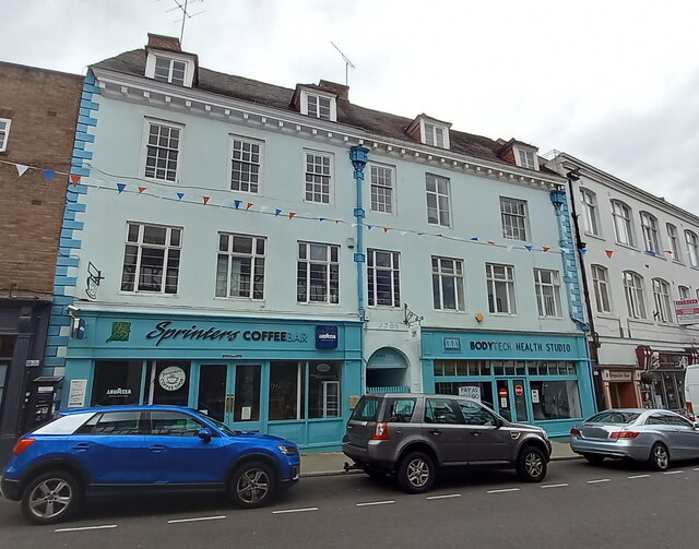
Image: © Richard Law Taken: 3 Jul 2022
Originally built in the early 18th century (the datestone above the central passageway says 1706) as two houses, possibly with commercial premises below. The current shopfronts are a 20th century replacement for the originals. The whole building was Grade II listed https://britishlistedbuildings.co.uk/101254608-20-20a-and-21-mardol-shrewsbury#.YuVqh3bMLIU & https://historicengland.org.uk/listing/the-list/list-entry/1254608 in 1953.
Images are licensed for reuse under creativecommons.org/licenses/by-sa/2.0
Image Location
Latitude
52.709001
Longitude
-2.75612