An aptly named house
Introduction
The photograph on this page of An aptly named house by Robert Graham as part of the Geograph project.
The Geograph project started in 2005 with the aim of publishing, organising and preserving representative images for every square kilometre of Great Britain, Ireland and the Isle of Man.

There are currently over 7.5m images from over 14,400 individuals and you can help contribute to the project by visiting https://www.geograph.org.uk
An aptly named house
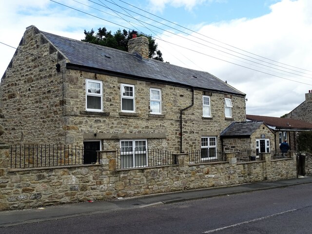
Image: © Robert Graham Taken: 4 Jul 2022
This is High House, on Rockwood Hill Road, Greenside village. It is indeed a high house, near the top of the steep hill on the western outskirts of the village. This part of the village is mostly early 20th century terraces, or more recent houses, but this one looks older. There were a few houses, presumably farms, along this road in the 19th century, and this looks as if it is one of those.
Images are licensed for reuse under creativecommons.org/licenses/by-sa/2.0
Image Location
Latitude
54.952198
Longitude
-1.791215