Bench Mark, Ardglass
Introduction
The photograph on this page of Bench Mark, Ardglass by Rossographer as part of the Geograph project.
The Geograph project started in 2005 with the aim of publishing, organising and preserving representative images for every square kilometre of Great Britain, Ireland and the Isle of Man.

There are currently over 7.5m images from over 14,400 individuals and you can help contribute to the project by visiting https://www.geograph.org.uk
Bench Mark, Ardglass
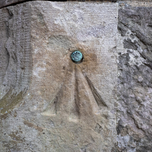
Image: © Rossographer Taken: 24 Jul 2022
Bench mark on the porch of the parish church in Ardglass Image This mark dates from the 1st geodetic levelling of Ireland which took place in 1839-43. It consists of a cut mark with a copper bolt driven into the wall of the church. The mark was included as a side level on the Dublin to Belfast line (branch levelling from Downpatrick to the tidal gauge in Ardglass Harbour - No. 14a) The original remarks for the mark describe it as "Ardglass Church. Copper bolt driven into blockstone at door; 0.7 ft. above mark on sill of door." The mark was originally levelled to 83.538 feet, later revised to 22.67 metres above MSL.
Images are licensed for reuse under creativecommons.org/licenses/by-sa/2.0
Image Location
Latitude
54.259968
Longitude
-5.608645