Llandinam Institute and hall
Introduction
The photograph on this page of Llandinam Institute and hall by Richard Law as part of the Geograph project.
The Geograph project started in 2005 with the aim of publishing, organising and preserving representative images for every square kilometre of Great Britain, Ireland and the Isle of Man.

There are currently over 7.5m images from over 14,400 individuals and you can help contribute to the project by visiting https://www.geograph.org.uk
Llandinam Institute and hall
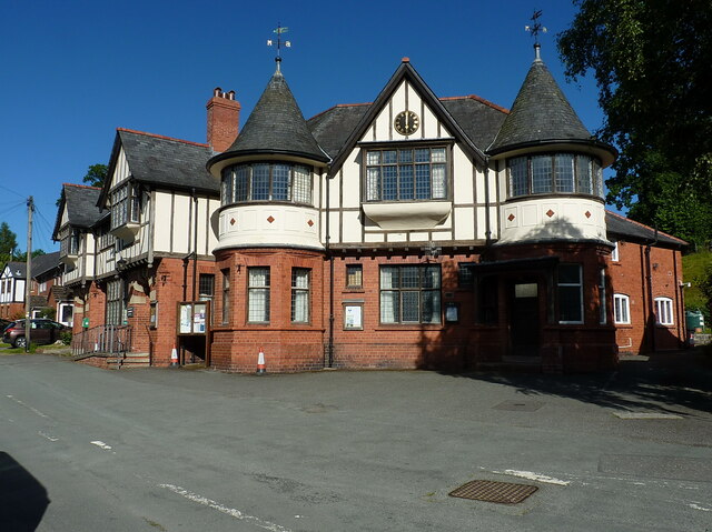
Image: © Richard Law Taken: 9 Jul 2022
Built around 1905-1910, and consisting of a library and meeting rooms, the Institute was Grade II listed in 1996. It is noted for illustrating the beneficence of the local Davies family of Plâs Dinam towards their village, the house being half a mile or so further north.
Images are licensed for reuse under creativecommons.org/licenses/by-sa/2.0
Image Location
Latitude
52.48488
Longitude
-3.436195