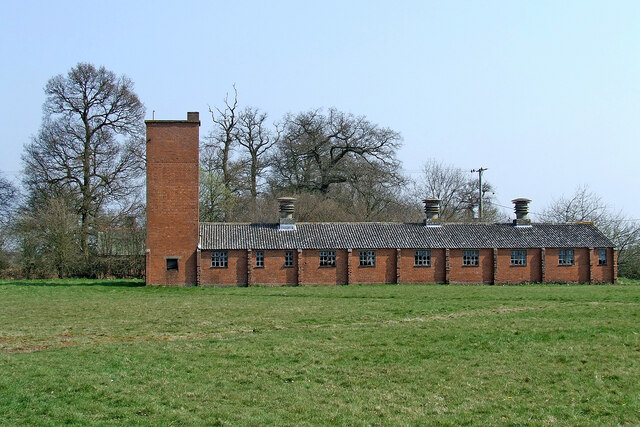
Former RAF accommodation by Cranmoor Lodge Farm, Staffordshire
Introduction
The photograph on this page of Former RAF accommodation by Cranmoor Lodge Farm, Staffordshire by Roger Kidd as part of the Geograph project.
The Geograph project started in 2005 with the aim of publishing, organising and preserving representative images for every square kilometre of Great Britain, Ireland and the Isle of Man.
There are currently over 7.5m images from over 14,400 individuals and you can help contribute to the project by visiting https://www.geograph.org.uk

Image: © Roger Kidd Taken: 1 Apr 2007
RAF Perton was open between 1941 and 1946 and was built on the site of a former First World War airfield. The village of Perton now occupies the site of the former airfield. Early 1940s RAF accommodation was here by Cranmoor Lodge Farm, and was later used as a barracks for a unit of the Dutch army. In 1947 RAF Perton was abandoned and given to the Agricultural Land Commission with the Dutch camp at Cranmoor becoming a refuge camp for Poles, Latvians and Lithuanians until 1950. (Information partially from https://en.wikipedia.org/wiki/RAF_Perton ) Around 2006, plans were submitted to convert the three main buildings to modern residential use, and also to similarly upgrade the farmhouse and its adjacent barns. Some buildings were to be demolished. Since the work was done it is difficult to take photographs from the same viewpoint. The land is private and fenced off. This https://webarchive.nationalarchives.gov.uk/ukgwa/20111002080342/http://www.sstaffs.gov.uk/pdf/Regulatory%20Committee%2022nd%20May%202007.pdf will result in the download of the 164 page detailed planning application. https://www.search.staffspasttrack.org.uk/details.aspx?ResourceID=40329&ExhibitionID=40329&PageIndex=4&SearchType=2&ThemeID=325#top

